Gli insediamenti intorno alla Bay of Kotor non sono sorti secondo un unico schema o piano. Si sono invece sviluppati in risposta a condizioni estremamente localizzate, modellate dal territorio, dall'accesso al mare e dalle esigenze economiche di lungo periodo. Il risultato è un paesaggio composto da tipologie insediative distinte che convivono in stretta prossimità pur rimanendo strutturalmente e storicamente separate.
La forma insediativa più compatta è il centro urbano fortificato. Queste città si svilupparono dove la protezione naturale poteva essere rafforzata tramite mura e punti di accesso controllati. Lo spazio all'interno delle fortificazioni era limitato, favorendo una costruzione densa, un'espansione verticale e l'integrazione di funzioni civiche, religiose e residenziali all'interno di un'area circoscritta. Questa struttura produceva un'intensa connettività interna ma limitava la crescita verso l'esterno.
Un chiaro esempio di questo modello è la Kotor Old Town, dove il tessuto urbano riflette secoli di adattamento a spazi ristretti. Le strade sono strette, gli edifici si elevano verticalmente e le infrastrutture pubbliche sono integrate direttamente nell'ambiente costruito. L'espansione avveniva solo quando le fortificazioni venivano ampliate o riadattate, rafforzando il carattere introverso della città.
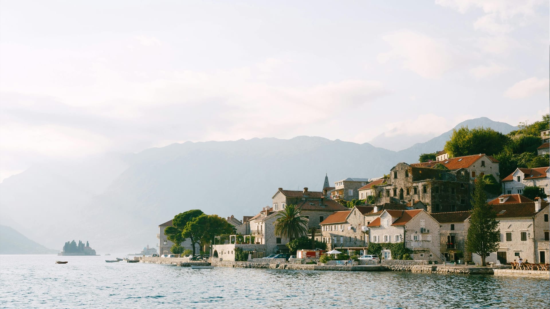
Oltre ai nuclei fortificati, si sviluppò una seconda tipologia insediativa lungo i tratti accessibili di costa. Questi insediamenti costieri lineari si formarono dove le condizioni del litorale consentivano un insediamento stabile senza la necessità di pesanti fortificazioni. Case, chiese e piccole strutture marittime erano disposte parallelamente all'acqua, creando comunità allungate piuttosto che città compatte.
In luoghi come Dobrota, questa struttura è particolarmente evidente. Anziché un unico centro, l'insediamento funziona come una sequenza di quartieri connessi distribuiti lungo la costa. La vita quotidiana era orientata verso il mare, e l'accesso marittimo plasmava l'attività economica e l'interazione sociale più dei collegamenti interni.

Una terza tipologia insediativa emerse sui pendii sovrastanti la costa. I villaggi collinari venivano spesso fondati per sostenere l'agricoltura, la residenza stagionale o la popolazione in eccesso nei periodi di pressione costiera. Queste comunità si basavano su terreni terrazzati e sentieri locali, barattando la facilità di accesso con un maggiore controllo sulle terre coltivabili.
Col tempo, molti insediamenti collinari declinarono man mano che la vita costiera divenne più pratica e sicura. Accessi difficoltosi, infrastrutture limitate e mutate priorità economiche portarono a un graduale abbandono in alcune aree. I resti di questi villaggi offrono uno spaccato di precedenti strategie insediative dettate dalla necessità più che dalla comodità.
Ciascuna tipologia insediativa riflette una risposta diversa agli stessi vincoli ambientali. Le città fortificate privilegiavano la difesa e l'amministrazione. I villaggi costieri ponevano l'accento sull'accesso marittimo e sul commercio. Le comunità collinari bilanciavano l'uso del suolo con l'isolamento. Insieme, queste forme illustrano una diversità strutturale degli insediamenti piuttosto che un unico modello regionale.
Questa diversità spiega perché la sola prossimità sia un indicatore inadeguato di somiglianza. Due luoghi separati da una distanza minima possono differire completamente per struttura, densità e funzione storica. Considerarli intercambiabili rischia di appiattire queste distinzioni e di travisarne lo sviluppo.

Anche l'organizzazione sociale fu plasmata da queste strutture. I centri urbani densi favorivano infrastrutture condivise e una regolamentazione collettiva, mentre i villaggi lineari sostenevano modelli abitativi più dispersi. Gli insediamenti collinari funzionavano spesso come unità semi-autonome, con un'interazione quotidiana limitata al di là dell'area immediatamente circostante.
Le infrastrutture moderne hanno modificato gli spostamenti tra gli insediamenti ma non hanno cancellato queste differenze strutturali. Le strade hanno migliorato l'accesso lungo la costa, tuttavia la forma insediativa è rimasta vincolata al territorio. L'espansione ha generalmente seguito gli schemi esistenti anziché crearne di nuovi, preservando gli assetti storici anche con l'evolversi degli usi.
Comprendere queste strutture insediative chiarisce inoltre perché molti luoghi vicini tra loro non siano amministrativamente o culturalmente unificati. La separazione tra città fortificate e comunità circostanti non era casuale; era radicata nel modo in cui lo spazio era organizzato e governato. Questa distinzione è approfondita in Come è conformata la Bay of Kotor: geografia, insediamenti e accessi, che illustra i vincoli fisici alla base di questi schemi.
Molti edifici e siti associati a queste diverse forme insediative compaiono nella directory sotto monumenti storici. Il loro significato diventa più chiaro quando li si osserva in relazione alle strutture insediative che servivano. Una chiesa in un villaggio lineare funzionava diversamente da una in una città fortificata, così come una cappella collinare rispondeva a esigenze ancora differenti.
Riconoscere la struttura insediativa consente di comprendere i luoghi secondo le loro peculiarità, anziché assimilarli a una narrazione centrale. La Bay of Kotor non è un'unica entità urbana con estensioni periferiche, ma una rete di insediamenti plasmati dalle condizioni locali. Preservare queste distinzioni garantisce che i luoghi conservino significato, contesto e chiarezza storica man mano che la directory continua ad ampliarsi.